Unless you’re living under a rock, it’s hard to miss the buzz circulating around the growing use of drones (officially known as UAVs—unmanned aerial vehicles) in applications as diverse as law enforcement, photography, and even oil rig inspections. The Harvard Business Review estimates that the drone business is poised to become a $7 billion industry by 2020, revolutionizing everything in its path.
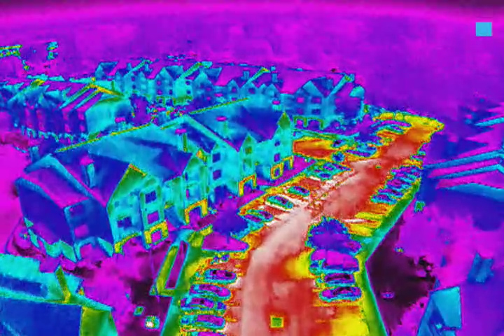
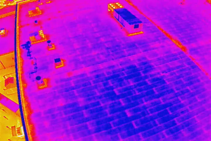
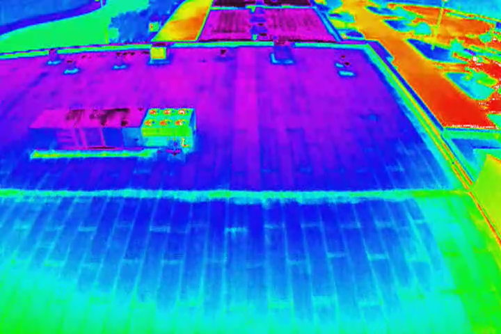
A few months ago, I had the opportunity to “test drive” a new infrared-equipped drone designed for use in the building assessment industry. I was impressed. From identifying water intrusion to improving the accuracy of repair efforts, these amazing little machines are set to transform the building assessment industry in at least three big ways.
We had the opportunity to test drive a new infrared-equipped drone designed for the building assessment industry. pic.twitter.com/w08iNGICPQ
— GLE Associates (@GLEAssociates) August 4, 2016
One: Identifying Water Intrusion Earlier, Better, and Cheaper
As any building owner or investor knows, water intrusion is one of a building’s greatest enemies. It often goes undetected for weeks or months or even years, penetrating ever deeper and causing rot, attracting pests, and encouraging mold growth. Over time, it can lead to significant structural damage.
Infrared imagery has been used for many years in identifying water intrusion. It works because over the course of a day, the sun heats up buildings, but areas with water in the walls or roof stay cooler than elsewhere. Infrared images make these hot-and-cool patterns visible, enabling an experienced building assessor to quickly identify areas of concern and uncover water intrusion before it has time to create major problems.
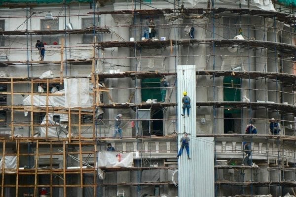
However, the use of infrared technology has been limited in scope due to the cost and logistical constraints of traditional infrared cameras. On large buildings, it can take several days to fully photograph all of the building’s walls and roof, and it can take hours for an experienced technician to review all of the photos, looking for problems. If the building is multi-storied, an assessor may need ladders or scaffolding in order to provide adequate coverage. High-rise buildings require helicopters or cranes for the job.
Infrared drones change all of that. An infrared drone operator can examine a building’s walls and roof, up to 400 feet, without physically walking more than a few steps. Most buildings can be completely examined in twenty to thirty minutes. What’s more, the video can be streamed live to a senior architect or engineer sitting in an office at a remote location. Because he or she can request specific angles or zooms, the inspection is just as thorough as it would be in person, but the senior professional’s time can be much more efficiently used, thus reducing the cost of water intrusion inspections.
Two: Assessing Property Condition Cheaper, Better, and Faster
Typically, a property condition assessment is done before a property purchase, and involves the assessor physically walking the property to examine each element. These assessments are critical to property owners and purchasers, but they have one important limitation: They do not include inspection of property elements that require ladders or scaffolds in order to inspect, or that could pose a physical danger to the assessor.
As drone technology becomes more common, that limitation will no longer hold much meaning. Up to about 400 feet, any element of a building or property can be quickly and easily examined by a drone at no risk to the assessor and without the use of ladders or scaffolds. That means air handling equipment, windows, vents, mechanical systems, and roof condition can all be inspected from the ground.
Further, a drone can make a visual inspection of a large property quick and easy with a fly-over, to identify any potential areas of concern without a time-consuming and sometimes unfeasible physical walk-through.
All of this can be accomplished with a single drone operator, with video live streamed to a senior professional on- or off-site, thus driving down cost and improving quality of the assessment simultaneously.
Three: Performing Repairs More Efficiently
When problems are identified by an assessment, the resulting data from a drone can be used to drive down repair costs and increase effectiveness of those repairs.
Traditionally, problems that occur behind walls (especially water intrusion) require the tearing-down of the walls to identify the full extent of the problem. Infrared drone technology can often provide critical information on the location and extent of problems, significantly reducing the amount of demolition required to complete the job, while increasing confidence that the full extent of the problem has been addressed.
Here at GLE, we believe in the future of UAVs to transform the entire architecture, engineering, and construction industries, from assessments to property management. We’re excited to announce that we currently have a dji Inspire 1 UAS with both a high definition camera and a FLIR infrared camera in our toolbox, and we’re seeing some exciting results for our clients. Contact us today to find out more.

